
The Pirenópolis Gold Project, Goiás State, Brazil
A Greenfields Gold Exploration Project
Brazil remains one of the most underexplored gold jurisdictions in the world. Over 50% of the country remains geologically unmapped at >1:250,000 scale.
It is estimated that for every $1 spent on exploration in Canada only $0.005 equivalent has been spent in Brazil, yet Brazil has a similar area of potential geology, as Canada.
It was only beginning in 1988 that Brazil allowed 100% foreign ownership of mineral rights. This partially explains the exploration gap.
The town of Pirenópolis in the state of Goiás, Brazil was founded during the 1740’s Gold Rush which continued through to the late 1800’s. Much earlier than the gold rush in Australia and North America and pre-industrialization and mechanized mining methods.
In the late 1800’s placer gold mining shifted from the rivers to ferricrete paleo channels and benches. The ferricrete was hard and mined by diverting water flow. The local population started turning to cattle and cane agriculture for an economic base as gold production dwindled and conflicts arose around downstream water quality from mining operations.
Other than a few small showings in the region, no primary source(s) has been found to explain the placer gold. This region has no evidence of modern, systematic exploration.

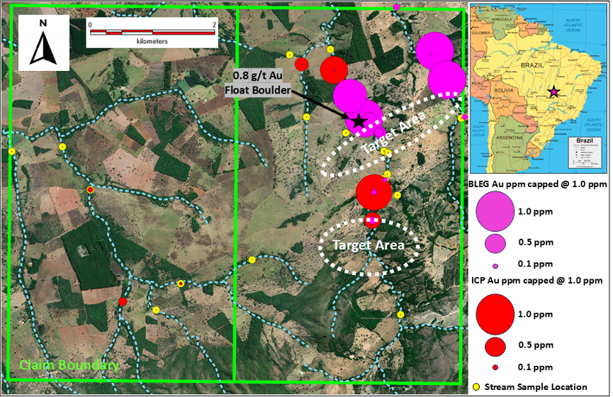
Pirenópolis Project 2025 Stream Sampling
Recent sampling returned high-grade stream sediment results demonstrating several gold in stream cut-off locations indicating local bedrock sources.
High-grade assay of 6.38 ppm gold (6.38 g/t Au), as well as four additional samples ranging from 1.64 ppm to 0.424 ppm gold in the 2 streams.
Gold reports differently to BLEG vs ICP analytical techniques in main drainage further suggesting different / multiple sources.
The northern gold in stream cut-off anomaly is proximal to a 0.8 g/t Au float boulder.
Anomalous results received from reconnaissance sampling on west claim is demonstrating potential.
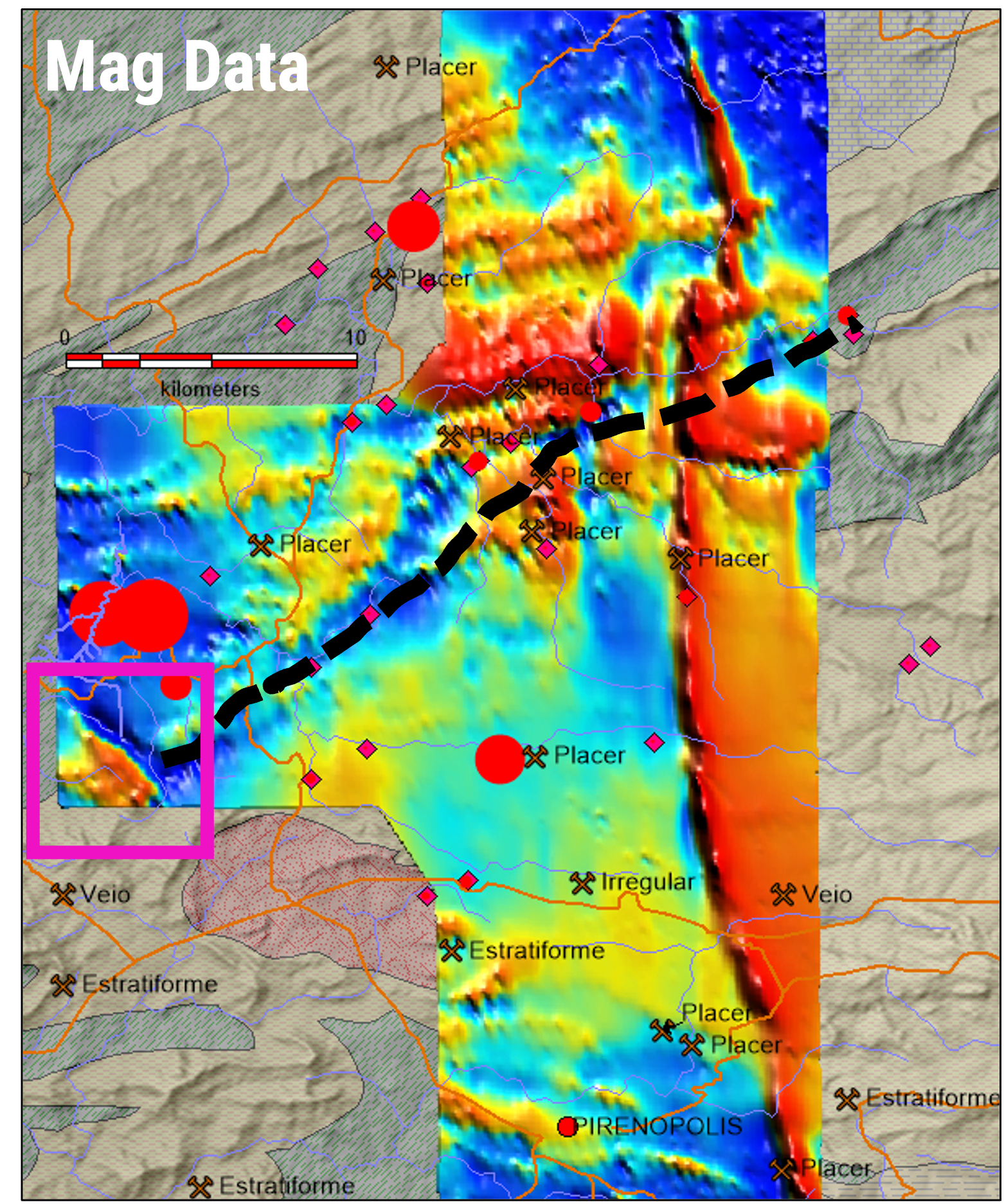
Regional Government Airborne Magnetic Data
A regional linear trend in the government airborne magnetics (black dash line) is interpreted as a district scale fault that could represent a conduit for mineralization.
Extensive thrust fault development is present at Paracatu.
The property has a magnetic high anomaly that appears to cross stratigraphy and may represent a late intrusive. This could be a mineralizing heat source.
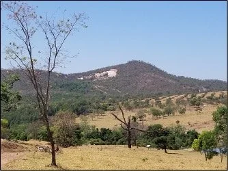
Property landscape showing quartzite mining in the background
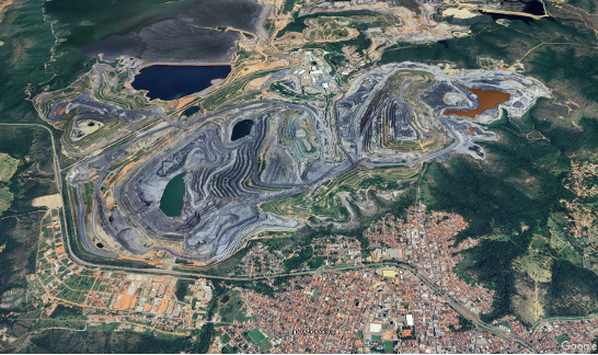
Kinross Paracatu Gold Mine: >16m Oz Au
Psuedo-stratiform deposit, hosted in carbonaceous phyllites.
The deposit formation model proposed for Paracatu suggests that gold and arsenopyrite were introduced concurrently during the regional deformation event.
Gold occurs as free gold and/or electrum
Highly profitable, large, low-grade (0.4g/t Au). Upgradeable (simple scrubbing lifts the grade as the rocks are friable).
The Pirenópolis Gold Project is in the same geologic belt and age of rocks.
Little to no evidence of competitors exploring for these type of deposits.
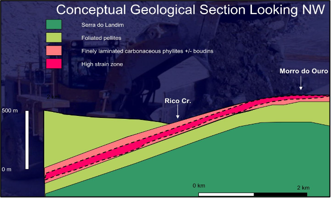
2020 NI43-101 8.9Moz Au mined, 8Moz Au proven and probable reserves